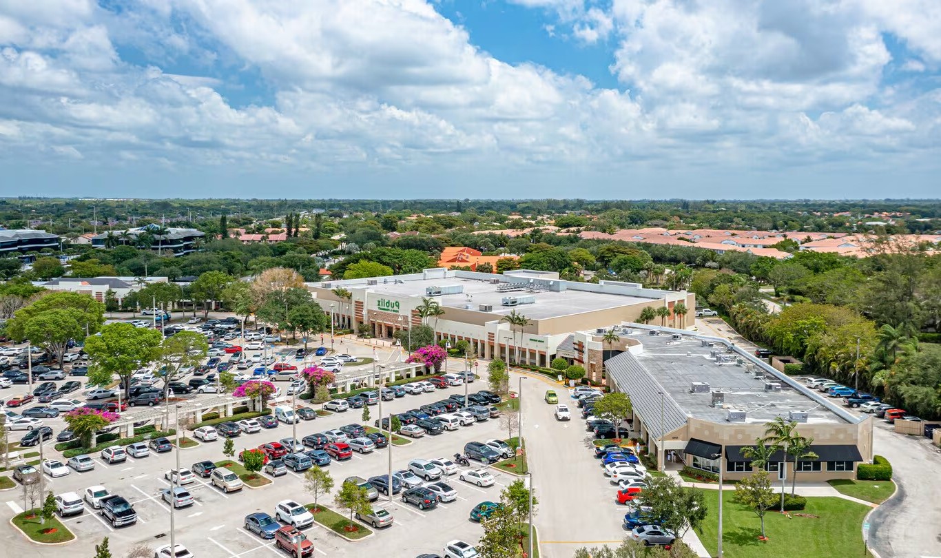
Approved Uses by Zoning — City CG Commercial General (CG)
Uses permitted by right under the municipality’s zoning for this district. The property may carry additional restrictions (deed, association or lease), so tenants are responsible for confirming their intended use with the municipality and landlord before committing.
Allowed by right
Retail store, Clothing / apparel store, Furniture store, Electronics store, Sporting goods store, Shopping centre / regional mall, Convenience store (no fuel, no vehicle service), Farmer's market, Fruit and vegetable market, Pharmacy, Restaurant, Fast food restaurant, Coffee shop, Catering service, Bar / nightclub (300 ft residential rule applies), Business office, Professional office, Medical office, Dental clinic, Medical or dental laboratory, Bank / financial institution, Barber shop, Beauty salon, Nail salon, Dry cleaner, Laundry service, Repair services (general), Print and copy shop, Gym / fitness center, Instructional school / tutoring, Child care center / daycare, Hotel, Indoor entertainment venue, Movie theater (indoor), Place of public assembly, Library, Commercial parking structure
With special approval
Auto repair shop (fully enclosed building), Automotive service station, Drive-through restaurant, Veterinary clinic (no overnight boarding), Pet daycare, School, Outdoor entertainment (east of Butts Road only), Regional transportation service
Nearby: 37,000 · BROWARD CO LINE | 13,000 · POWERLINE RD
Neighborhood Demographics · Census Tract 007623
Figures for the census tract this property sits in — the immediate surrounding neighborhood (roughly ½–2 sq. mi). For distance‑based totals, see the 1 / 3 / 5‑mile rings below.
4,075
Population
$112,083
Median Household Income
31
Median Age
1,159
Households
$736,000
Median Home Value
Household Income of 1,159 households
<$50k201 17%
$50–100k259 22%
$100–150k271 23%
$150k+428 37%
Age of 4,075 residents
Under 181,523 37%
18–34669 16%
35–541,090 27%
55–64272 7%
65+521 13%
Frontage Traffic vs. Palm Beach County's Busiest Roads
This property fronts W Palmetto Park Rd. Below, its measured daily traffic (FDOT count) is compared to five of the county's busiest roads — I‑95, Florida Turnpike, Okeechobee Blvd, US‑1/Federal Hwy, and Military Trail (approximate peak AADT) — to show how much exposure the location gets.
117,400vehicles / day on W Palmetto Park Rd (AADT)
I‑95 (interstate)255,000
◆ W Palmetto Park Rd117,400
Florida Turnpike95,000
Okeechobee Blvd62,000
US‑1 / Federal Hwy46,000
Military Trail40,000
This frontage carries about 46% of I‑95's volume — strong major‑arterial exposure. County roads shown are approximate peak AADT.
FDOT count stations on W Palmetto Park Rd 117,400 AADT between NORTH END BR #860184 and Bridge No-930416 (2025) 48,500 AADT (2025) 15,500 AADT between MARINA BLVD/SW 18 ST and EB W PALMETTO PK RD (2025) 4,200 AADT between BOCA DEL MAR DR and BOCA DEL MAR DR (2025)
Risk & Incentives
🌊 Flood Zone X · minimal✓ Not in Flood HazardNot an Opportunity Zone
Street ViewClick to load · then drag to look around
Lease Rate
Upon Request
Listing Courtesy of Avison Young
Nikki Traff
Avison Young
Inquire about this property
Key highlights
Fully Built-Out as Standard Retail Space
Located in-line with other retail
Extended Unit Specifications
Suite1st Floor, Ste 38
Available—
Clear Height—
Drive-In Bays—
Dock-High Bays—
Office SF—
Restrooms—
Parking Ratio2.1/1,000 SF
Op. Expenses—
Appraiser Data
Parcel Control No.00-42-47-28-01-021-0010
Building UseDISTRICTS
DOR Use CodeSHOPPING CENTER CMMITY — DISTRICTS
Assessed Value$48,181,856
Land Value$22,407,450
Improvement Value$25,774,406
Total Taxable Value$0
Land UseDISTRICTS
Legal Description
28-47-42, L-48, L-49, L-50 & E
Source: Palm Beach County Appraiser Records
Proximity
✈ Airports
Palm Beach Intl (PBI)23.8 mi
Ft. Lauderdale (FLL)18.7 mi
Miami Intl (MIA)38.6 mi
⚓ Seaports
Port of Palm Beach30.8 mi
Port Everglades18.2 mi
PortMiami39.4 mi
More available units in this building · 7060 W Palmetto Park Rd