Location MapClick to explore · switch to satellite inside the map
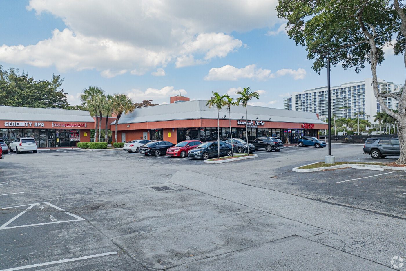
Photo
1 / 2
Floor Plan
Floor plan not available yetAsk us and we'll get it to you as soon as it's available.
Building Description
The shopping center is centrally located in the heart of a rapidly growing residential and retail market at the intersection of Sunrise Blvd and Federal Hwy in Ft. Lauderdale.
Bus Line
Pylon Sign
Signage
Signalized Intersection
Approved Uses by Zoning — Residential Mid Rise Multifamily/Medium High Density (RMM-25)
Uses permitted by right under the municipality’s zoning for this district. The property may carry additional restrictions (deed, association or lease), so tenants are responsible for confirming their intended use with the municipality and landlord before committing.
Allowed by right
Single Family Dwelling, Single Family Dwelling, Attached: Cluster Dwellings (Sec. 47-18.9), Single Family Dwelling: Zero-lot-line Dwelling (Sec. 47-18.38), Single Family Dwelling, Attached: Duplex/Two (2) Family Dwelling (Sec. 47-18.45), Single Family Dwelling, Attached: Townhouses (Sec. 47-18.33), Multifamily Dwelling: Coach Home (Sec. 47-18.10), Multifamily use, Community Residence, 3 residents maximum (Sec. 47-18.47), Community Residence, 4 to 10 residents; 1,000' distance separation (Sec. 47-18.47), Existing Multifamily Dwelling (Sec. 47-18.39), Active and Passive Park (Sec. 47-18.44), Social Service Residential Facility, Level I (Sec. 47-18.32), Family Day Care Home (Sec. 47-18.8), Urban Agriculture / urban farms and community gardens (Sec. 47-18.41; allowed only where the 47-18.41 zoning/land-use-designation conditions are met)
With special approval
Community Residence, 4 to 10 residents, less than 1,000' distance separation (Sec. 47-18.47), Community Residence, more than 10 residents / Community Residence, no license or certification available (Sec. 47-18.47), Bed and Breakfast Dwelling (Sec. 47-18.6), Hotel (Sec. 47-18.16), Mixed Use Development (Sec. 47-18.21), House of Worship (Sec. 47-18.17), School, Social Service Residential Facility, Level II (Sec. 47-18.32), Small and Intermediate Child Day Care Facility (Sec. 47-18.8), Nursing Homes (Sec. 47-18.23)
Figures for the census tract this property sits in — the immediate surrounding neighborhood (roughly ½–2 sq. mi). For distance‑based totals, see the 1 / 3 / 5‑mile rings below.
3,960
Population
$83,047
Median Household Income
47
Median Age
1,952
Households
$562,300
Median Home Value
Household Income of 1,952 households
<$50k643 33%
$50–100k395 20%
$100–150k315 16%
$150k+599 31%
Age of 3,960 residents
Under 18267 7%
18–34952 24%
35–541,323 33%
55–64591 15%
65+827 21%
Trade-Area Rings · Distance from Property
Everyone living within a straight‑line radius of the property — the classic retail trade area. Each ring is cumulative (the 3‑mile total includes the 1‑mile).
1 Mile
16,684
population
8,875 households
$135,903 avg income
3 Miles
125,709
population
59,976 households
$127,824 avg income
5 Miles
261,332
population
110,497 households
$111,001 avg income
Frontage Traffic vs. Palm Beach County's Busiest Roads
This property fronts S Federal Hwy. Below, its measured daily traffic (FDOT count) is compared to five of the county's busiest roads — I‑95, Florida Turnpike, Okeechobee Blvd, US‑1/Federal Hwy, and Military Trail (approximate peak AADT) — to show how much exposure the location gets.
75,500vehicles / day on S Federal Hwy (AADT)
I‑95 (interstate)255,000
Florida Turnpike95,000
◆ S Federal Hwy75,500
Okeechobee Blvd62,000
US‑1 / Federal Hwy46,000
Military Trail40,000
This frontage carries about 30% of I‑95's volume — strong major‑arterial exposure. County roads shown are approximate peak AADT.
FDOT count stations on S Federal Hwy 75,500 AADT (2025) 38,500 AADT between US-1/SR-5/N FEDERAL (2025) 13,400 AADT (2025) 11,100 AADT between NE 15 AVE and N FEDERAL HWY (2025)
Risk & Incentives
🌊 Flood Zone X · minimal✓ Not in Flood HazardNot an Opportunity Zone
Street ViewClick to load · then drag to look around
Lease Rate
$36.00/SF/YR
Listing Courtesy of Axiom Capital Advisors
Roberto Susi
Axiom Capital Advisors
Inquire about this property
Key highlights
Lease rate does not include utilities, property expenses or building services